
Topo Survey Before Designing a Driveway Across Steep Hill Country Terrain
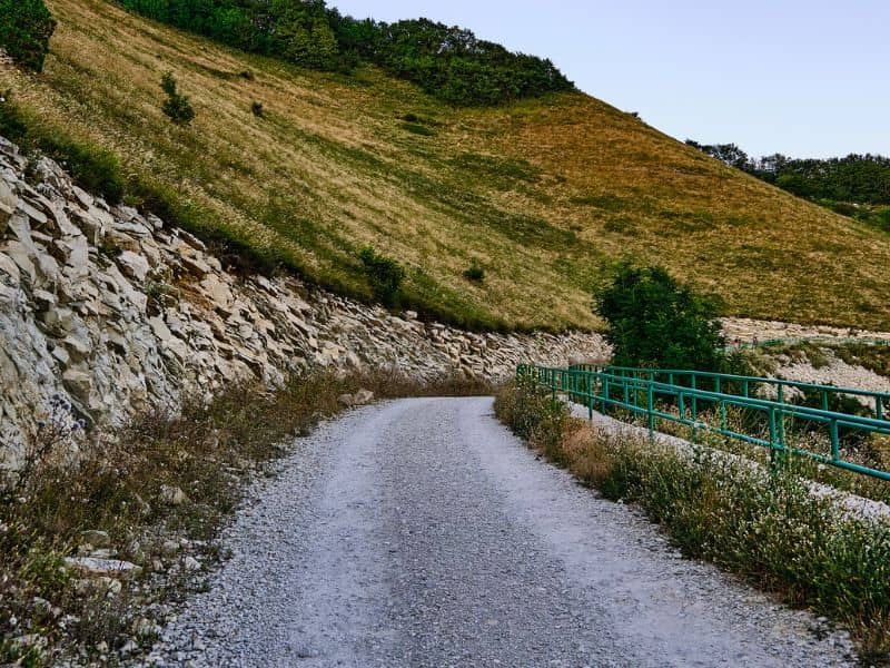
A loaded concrete truck can weigh several times more than your pickup. If the driveway to your homesite is too steep, too tight, or washed out by the first big storm, that truck may not make it up the hill. The same goes for fire trucks, delivery vans, and the moving truck on the day you finally move in.
On steep, rocky land, the driveway often becomes one of the hardest and most expensive parts of the project. A topographic survey gives your designer and contractor an accurate map of the ground before they pick a route. That map is what turns a rough guess into a driveway that works, drains, and holds up.
How a Topographic Survey Reveals Steep Slopes and Elevation Changes
A good topo also shows features that matter for access. Trees, fences, existing roads, culverts, power poles, and drainage channels all get mapped. Together, the contours and features show where a driveway can climb and where it can’t.
On steep hillsides, field crews usually collect extra points along breaks in slope, like the top and bottom of a ledge or the edge of a creek bank. Ask your surveyor how dense the data will be along likely driveway routes. More detail there leads to better grade and cost estimates later.
Evaluating Driveway Grades and Potential Access Routes
Driveway grade is the steepness of the drive, usually shown as a percentage. A 10 percent grade rises 10 feet over 100 feet of length. Steeper grades are harder to build, harder to drive, and harder to keep from eroding.
Grade limits can vary by county, city, fire code, and HOA rules. Some places set a maximum grade for emergency access, and others leave it to the designer. Check the rules for your property early, since they can rule out a route that looks fine on paper.
With a topo in hand, your designer can trace several routes and compare them. A straight path up the hill may be short but too steep. A longer route that follows the contours can lower the grade, though it may need more clearing, more turns, and more drainage work.
Look at the turns too. Tight switchbacks on a slope can trap long vehicles and make winter or wet-weather driving tricky. Plan room for trucks to turn around near the house, since backing down a steep drive is no fun for anyone.
Identifying Rock Outcrops and Terrain Features That Affect Driveway Design
Rock can change a driveway budget fast. Limestone ledges and exposed outcrops are common on rugged sites, and cutting through them may take heavy equipment, rock saws, or other methods. A route that avoids a big ledge can save real money.
The topo survey can show surface rock, ledges, and steep breaks in grade. It won’t show how deep the rock goes or how hard it is below the surface. For that, a geotechnical engineer may recommend test holes or borings along the planned route.
Watch for other features that shape the route as well:
- Draws and creek crossings that carry storm runoff.
- Large trees you want to save.
- Fences, wells, septic areas, and utility lines.
- Easements and property lines near the route.
Pair the topo with a boundary survey if the driveway runs close to a property line. A road that drifts onto the neighbor’s land creates a problem no amount of grading can fix.
Planning Cut, Fill, and Retaining Walls Along the Driveway
Cut means digging into the hill to lower the ground. Fill means placing soil or rock to raise it. Most hillside driveways use both to create a flat, steady driving surface.
The topo lets an engineer or designer estimate cut and fill volumes before work begins. Balancing the two keeps costs down, since moving extra material on or off a site adds trucking costs. It also shows where the cut or fill slopes will be too steep to stand on their own.
Where slopes can’t be laid back far enough, retaining walls hold the ground in place. Walls add cost and may need an engineer’s design, depending on height, soil, loads, and local rules. Ask about wall needs early, because they can change which route makes the most sense.
Using Topographic Survey Data for Drainage and Driveway Construction Plans
Water is the biggest enemy of a hillside driveway. Runoff picks up speed on steep ground and can wash out gravel, undercut pavement, and fill ditches with debris. The topo shows where water comes from and where it wants to go.
Designers use that data to place ditches, culverts, and water bars that move runoff off the drive at safe points. Culverts at draws and low spots need to be sized for the flow they’ll carry. The plan should also avoid sending concentrated water onto a neighbor’s property or into an eroding slope.
Once the design is set, the same topo data supports construction. Surveyors can stake the centerline, edges, and grade points so the contractor builds what was designed. Driveway permits, culvert approvals, and access rules can vary by county and road authority, so confirm requirements before construction starts.
Frequently Asked Questions
What is a topo survey?
A topo survey is a map of the land’s shape and elevation. It shows contour lines, slopes, and site features like trees, fences, and drainage paths. Designers and engineers use it to plan grading, drainage, and access. On steep land, it’s one of the first surveys most projects need.
Do I need a topo survey for a gravel driveway?
Even gravel driveways benefit from a topo on steep ground. Grade, drainage, and erosion problems affect gravel and paved drives alike. Gravel can wash away fast on a steep slope with poor drainage. A topo helps you plan a route that lasts with less upkeep.
How steep can a driveway be?
There’s no single answer for every property. Limits can vary by county, city, fire code, HOA rules, and driveway surface. Steeper drives cost more to build and can be harder for emergency vehicles. Check local rules and talk with your designer before choosing a route.
Will a topo survey show rock under the ground?
A topo survey shows surface features, including visible rock and ledges. It doesn’t show what lies below the surface. A geotechnical engineer can test the subsurface with borings or test pits. That information helps estimate excavation costs more accurately.
When should I order a topo survey for my driveway?
Order it before design starts, ideally soon after you buy the land. The designer needs the data to compare routes and estimate grading. Survey schedules can vary, especially on large or wooded sites. If your build schedule or permits depend on the design, contact a surveyor early.
