↓
 

San Antonio Land Surveying

Local Land Surveyors in San Antonio, TX

San Antonio Land Surveying
  • Home
  • ALTA Survey
  • Boundary Surveying
  • Construction Survey
  • Drone LiDAR Mapping
  • Elevation Certificate
  • Land Surveying
  • Topographic Survey
  • About Us
  • Blog
  • Contact Us
Home - Page 2 << 1 2 3 4 … 11 12 >>

Post navigation

← Older posts
Newer posts →

Flood Elevation Survey for Homes Near Low-Water Crossings After Channel Changes

San Antonio Land Surveying Posted on September 16, 2026 by SanAntonioSurveyorSeptember 15, 2026
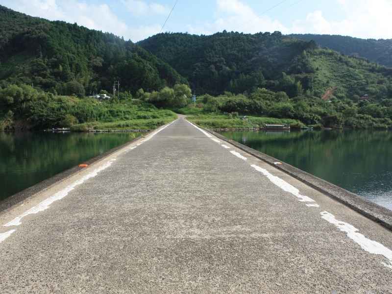
Flood elevation survey near a low water crossing in San Antonio Texas.

A creek that shifts course can quietly change how much flood risk a home faces, even if nothing on the lot itself moved. Homes near low-water crossings feel this the most. A low-water crossing is a road that dips down to cross a creek and can flood during heavy rain. The crossing and the creek work together to control how water moves through a neighborhood. A flood elevation survey tells you if your old flood paperwork still matches what’s really happening now.

This matters for insurance, selling your home, and peace of mind. Old flood data based on a creek that has since moved, gotten wider or gotten deeper can be badly out of date. This article explains which heights matter after a creek changes, how to compare your home to a nearby low-water crossing, and when to get new flood height data.

Which Elevations Matter After a Channel Has Changed?

After a creek channel changes, the heights that matter most are your home’s lowest floor height, the base flood height for your area, and the current height of the creek channel itself. A flood elevation survey ties these numbers together so you know exactly where you stand.

Key heights to track:

  • Lowest floor elevation. This is the height of your home’s lowest livable floor. For homes without a basement, this can include an attached garage in some cases.
  • Base flood elevation (BFE). This is how high floodwater is expected to reach during a major flood, based on FEMA flood maps.
  • Channel elevation. This is the current depth and shape of the nearby creek or drainage channel. It can change after erosion, dirt buildup, or a flood.

A creek that scoured out deeper, or filled in with dirt and debris, changes how much water it can hold before it overflows. That change can raise the real flood risk for nearby homes, even if FEMA’s official maps haven’t caught up yet. A current survey shows what’s actually happening on the ground, not just what an old map says.

Has the Channel Shifted Relative to the Home?

Checking whether a creek channel has physically moved compared to your home is a key part of a flood elevation survey after a flood or after years of slow erosion. Channels near low-water crossings move more often, because water speeds up and pushes harder around the crossing.

A surveyor checking for channel shift will usually:

  • Compare the creek’s current spot and shape to older survey data, if it exists
  • Note any new erosion, dirt buildup or changed banks near the property
  • Note whether the creek has moved closer to or farther from the home’s foundation
  • Record current bank and channel bottom heights to compare against older numbers

Creeks and drainage channels, especially ones that feed into the bigger watershed around the city, have moved a real amount after big rain events in recent years. A creek that shifted even a few feet closer to a foundation, or dug in deeper after a flood, can change both the physical risk to the house and how that risk gets figured for insurance and planning.

How Does the Home Compare With the Low-Water Crossing?

Comparing your home’s height to the nearby low-water crossing shows how the two act during a flood, since the crossing usually floods over before water reaches higher ground nearby. This relationship, more than just distance, often decides how a home experiences rising water.

Things a flood elevation survey can make clear:

  • The height difference between the crossing’s road surface and your home’s lowest floor
  • Whether recent channel changes have made the crossing flood faster during rain
  • Whether the home sits upstream or downstream of the crossing, which changes the timing of rising water
  • How access to the home might be affected if the crossing floods before the home does

Low-water crossings are common. They’re built to let water flow over the road during heavy rain instead of pushing water toward a higher, more damaging path. That means a flooded crossing doesn’t always mean your home is flooding too. A survey helps confirm exactly how the two connect on your property.

When Should Elevation Data Be Updated After Flooding?

Flood height data should get updated after any flood that seems to have changed the creek channel, after visible erosion or dirt changes near the property, or when your flood paperwork is more than a few years old and hasn’t kept up with known changes nearby. Waiting too long to update this data can leave you working from numbers that no longer match the real ground.

Situations that call for updated height data:

  • After a flood that caused visible erosion, new dirt buildup or changed banks near the channel
  • Before selling a home, since buyers and lenders may ask for current flood height paperwork
  • Before renewing or changing flood insurance, since old height data can throw off your rate
  • When a neighborhood has seen construction changes, like crossing repairs or channel work done by the city or county

Rules for updated height data can change based on your lender, your insurer and your city, so confirm exactly what you need instead of assuming one rule fits everywhere. If a sale, refinance or insurance renewal is on a deadline, get your height data updated early so it doesn’t slow things down.

How Survey Data Supports Flood and Property Decisions

Accurate flood elevation survey data helps with several real decisions, from insurance costs to building plans to selling a home. It swaps guesswork for real, confirmed numbers. This data matters even more for homes near low-water crossings, where flood behavior ties directly to nearby channel and crossing conditions, more than it does on a typical inland lot.

Ways this data gets used:

  • Backing up or pushing back on a flood insurance rate based on current height paperwork
  • Guiding plans for an addition, garage or other structure near a flood-prone spot
  • Giving proof for a home sale where flood history or channel changes are a concern
  • Giving a homeowner solid facts to bring up drainage or channel concerns with the city or county

A flood elevation survey doesn’t remove flood risk. But it gives you a true picture of where you stand today. For homes near a shifting creek or a low-water crossing, that accuracy matters more than it does on a lot with steady, unchanging drainage nearby.
Posted in elevation certificate | Tagged elevation certificate

Residential Survey Before Rebuilding a Detached Structure Damaged by High Winds

San Antonio Land Surveying Posted on September 9, 2026 by SanAntonioSurveyorSeptember 7, 2026
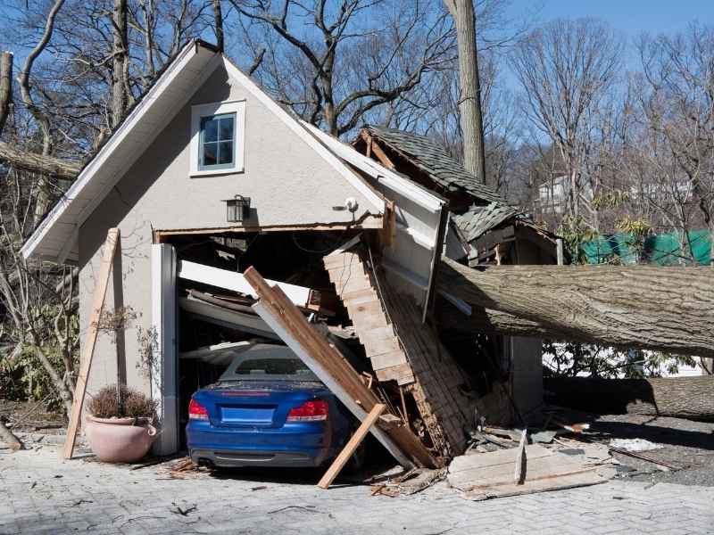
Residential survey for a wind-damaged detached garage before rebuilding in San Antonio,Texas

High winds can flatten a garage, twist a shed off its base, or tear apart a workshop in minutes. When the storm passes and it’s time to rebuild, guessing where the old structure stood is a real gamble. A residential survey gives you exact measurements instead of guesswork, so the new structure goes up in the right spot with proper records behind it. 

Confirming the Original Footprint Before Reconstruction

Once a detached structure is damaged, its exact outline often disappears fast. Debris gets cleared. Slabs get demolished. Grass grows back over old corner markers within a season or two.

A residential survey can record the true footprint of the structure before any of that happens. This means the corners, the length and width, and the exact spot on the lot where the building once stood. That record becomes your reference point for everything that follows.

Without it, rebuilding often relies on memory or old photos. Photos can be misleading. Memory fades. Neither one gives you numbers you can hand to a contractor or a building department.

Will the Rebuilt Structure Stay in the Same Spot?

Before you rebuild, decide whether the new garage, shed, or workshop will sit in the exact same location or move somewhere close by. This sounds like a small detail. It isn’t.

Even a shift of a few feet can change how the structure relates to your property line, your driveway, or nearby trees. It can also affect the site plan a contractor uses to pull permits. A plan built around the wrong location can cause delays or force a redesign midway through construction.

A residential survey settles this question with hard numbers instead of a rough guess. You’ll know the old position, and you can compare it to whatever new position you’re considering. That comparison should happen before drawings are finalized, not after.

When Wind Damage Hides Where the Structure Used to Stand

Sometimes wind doesn’t just damage a structure. It moves it. A shed can slide off its footing. A garage roof can collapse inward, pulling the walls with it. A workshop can be torn apart so completely that nothing recognizable is left standing.

In these cases, you can’t just look at the wreckage and know where the building used to be. The debris pile might sit several feet from the true original spot. Foundation pieces might have shifted or cracked apart.

A survey crew can take field measurements and cross-reference them with older property records to pin down the real former location. This matters most after severe damage, when visual clues are unreliable or gone completely..

Using Survey Measurements to Guide the Rebuild

Once the original footprint and any new positioning decisions are settled, that information needs to reach the people doing the actual building work. A contractor or designer preparing plans for the replacement structure needs accurate numbers, not estimates.

Survey measurements give them exact distances to work from. This helps avoid awkward surprises, like a foundation poured too close to a fence or a structure that ends up a foot off from what the permit application described.

This isn’t about redoing a full property survey or repeating setback rules you may have already reviewed elsewhere. It’s about making sure the specific numbers for this one rebuild are correct from the start. Good measurements early on save time and money later, especially if inspections or approvals are part of the process.

Checking the Finished Structure Against the Approved Plan

After construction wraps up, it’s worth confirming that the finished structure actually sits where the approved plan said it would. Construction crews are careful, but small shifts happen. A structure can end up a foot or two off from its intended spot without anyone noticing right away.

A follow-up check compares the built structure’s actual position to the plan that was approved. If everything lines up, you have solid documentation showing the rebuild was done correctly. If something is off, you’ll find out now, while it’s still simple to address.

This step protects you down the road too. Future property records, refinancing, or a home sale can all raise questions about a structure’s exact location. Having that confirmation on file means you won’t be scrambling to answer those questions years later.

Frequently Asked Questions

Why get a residential survey before rebuilding a detached structure? 

A survey gives you exact measurements of where the old structure stood. This helps you avoid guesswork and keeps your rebuild plans accurate from day one.

Can a survey determine where a wind-damaged garage or shed was originally located? 

Yes. Even if the structure was destroyed or moved by wind, a survey crew can use field measurements and existing property records to find the original spot.

Does rebuilding in the same footprint still require updated survey information? 

Often, yes. Confirming the exact original location, rather than assuming it, helps avoid small errors that can affect permits or future property records.

What if the replacement detached structure will be larger than the damaged one? 

A residential survey helps confirm how a larger footprint fits on the lot in relation to the original location, which matters for planning and permit approval.

Can a residential survey help contractors plan the rebuilt structure accurately? 

Yes. Contractors and designers rely on accurate measurements to prepare site plans. Survey data gives them numbers they can trust instead of estimates.

Should the rebuilt detached structure be checked again after construction is complete? 

A post-construction check confirms the finished structure matches the approved plan and location, which helps prevent future property record issues.

Posted in land surveying | Tagged Land Surveying

Property Line Survey When a Retaining Wall Follows the Slope Instead of the Deed

San Antonio Land Surveying Posted on September 2, 2026 by SanAntonioSurveyorAugust 30, 2026
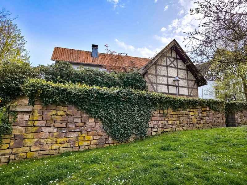
Property line survey for a retaining wall following a residential slope in San Antonio Texas

A retaining wall looks like a clear property marker, so people trust it. That trust can be a mistake. Walls often get built along the shape of the land, following the slope where it’s easiest to hold back soil. The deed line, though, is a set of legal measurements that may run somewhere else entirely. A property line survey shows where your boundary truly sits and how the wall lines up with it. When the two don’t match, that gap can cause real trouble down the road.

Check If the Wall Sits on the Line or Just the Slope

Builders place retaining walls where the ground needs holding, not where a surveyor’s map says the line runs. A crew building on a hillside follows the grade, because that’s what keeps the soil in place. The result can look like a boundary while sitting feet away from the real one. A property line survey settles which is which.

The survey marks your deeded corners and the line between them. Then it plots the wall against that line. Sometimes they sit right on top of each other. Often they don’t, and that difference is the whole point of checking.

Spot Where the Wall Drifts Across the Boundary

A wall that follows terrain rarely stays a fixed distance from the line. It might start on your side, then drift over as the slope curves. By the far end, part of it could sit on the neighbor’s land. One glance at the wall won’t catch that slow creep.

Measured offsets fix the problem. The surveyor records the distance from the wall to the line at several points along its length. Those numbers show exactly where the wall stays clear and where it strays. Trusting the wall as the line, without those checks, is how disputes start.

Find the Wall Parts You Can’t See

The face of a wall is only the part you notice. A retaining wall reaches out and back in ways that stay hidden. Footings spread underground past the visible base. Tiebacks and buried anchors can extend many feet into the soil behind it, and drainage outlets or caps may stick out at the top or bottom.

All of these count as part of the wall’s real footprint. A footing that crosses the line is still an encroachment, even if nobody sees it. A survey that maps the full system, not just the face, gives an honest picture. That saves an argument when someone digs and finds a footing next door.

Plan for Who Reaches the Wall to Fix It

Walls need upkeep, and someday this one will too. If the wall sits right at the line, working on its back or its base may mean stepping onto the neighbor’s yard. That’s a lot easier to sort out before a repair than during one. The survey shows how close the wall runs to the boundary.

With those distances in hand, owners can plan ahead. Maybe a written agreement about access makes sense while everyone gets along. The survey doesn’t decide who has the legal right to cross, but it shows where the need might come up. That heads-up is worth having early.

Measure Everything Before You Rebuild

Replacing or rebuilding a wall is the moment mistakes get locked in. Once new footings go in, moving them is slow and pricey. Before any of that starts, the wall, the slope, and the property line all need accurate measurements. Engineers and contractors build from those numbers.

Good data keeps a new wall from repeating an old error. If the last wall crept over the line, the survey lets the team pull the rebuild back to safe ground. It also gives the engineer the slope details needed for a sound design. Solid measurements first mean fewer regrets after the concrete cures.

Frequently Asked Questions

Does a retaining wall automatically mark the property line? 

No, a retaining wall does not always sit on the property line. Builders often place walls to hold back soil, following the slope of the land. The legal boundary comes from the deed, which may run somewhere else. Only a survey can confirm where the line actually falls.

Can a retaining wall follow the slope and still cross a surveyed boundary? 

Yes, a wall built along terrain can drift over the line. It may start on your property and gradually cross as the slope curves. A single look won’t catch that slow shift. Measured offsets along the wall show where it stays clear and where it strays.

What parts of a retaining wall should be located during a property line survey? 

A survey should map more than the visible face of the wall. Footings, caps, drainage outlets, and buried tiebacks can all reach past the main structure. Any of these may cross the line even when the face does not. Locating the full system gives an accurate footprint.

Should property lines be checked before repairing or replacing a retaining wall? 

Yes, checking the line before major work is a smart move. New footings are hard and costly to move once they’re set. Accurate measurements let the crew build in the right spot from the start. That avoids repeating an old encroachment or creating a new one.

Can a survey help determine whether maintenance access may involve neighboring property? 

A survey can show how close the wall runs to the boundary. That distance hints at whether future repairs might need access from next door. The survey itself doesn’t grant or decide access rights. It gives owners the facts to plan and document access before work begins.

Posted in boundary surveying | Tagged boundary survey

Post navigation

← Older posts
Newer posts →
Get Quote Button
© Boxer Survey USA
San Antonio Land Surveying

San Antonio, Texas
Phone: (210) 405-7250

Privacy Policy | Terms of Use

Web Development and SEO by:
AuburnBusiness.com, LLC


Privacy Policy | Terms of Use

The owner of this website, Boxer Survey USA, provides coordination of professional land surveying and engineering services in all 50 states. The professional surveying and engineering services provided to you will be conducted by fully licensed professionals in your state.

↑