Every road, bridge, water line, and drainage system starts with a clear plan. Even the best design will fail if builders do not place every part in the exact right spot and at the correct height. This is where construction survey methods come in. They act as the project’s guideposts from the first day to the final inspection. Without accurate measurements, small mistakes can grow into big problems that require tearing out and rebuilding work. That costs time, materials, and money that could have been saved.
Why Control Networks Matter Before Heavy Construction Begins
Before any machine moves dirt or pours concrete, teams set up a control network. This is a set of fixed points on the ground with known horizontal positions and vertical heights. These points create a reliable reference system that every worker and machine can use throughout the whole project. They act like a map that never changes, even when work spreads across large areas or takes many months to finish.
If this reference system is wrong, every step that follows will be off. A road built too low might hold water instead of draining it. A bridge support placed slightly out of line can create safety risks and require major fixes later. Utility lines laid in the wrong spot can clash with other structures, leading to costly digs and relocations. By getting the control network right from the start, crews keep consistency across all phases, from clearing land to opening the finished project.
How Construction Staking Keeps Crews Building in the Right Location
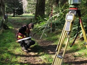
Once control points are in place, surveyors mark specific spots for construction staking. These marks show exactly where to dig, how deep to go, where the edges of roads or foundations will sit, and how steep slopes should be. They turn numbers on paper into visible guides on the ground so operators and workers know exactly what to do.
Clear and accurate staking reduces confusion in the field. It helps crews avoid cutting too deep or building too far to one side. When everyone follows the same marked lines, there is less chance of having to tear out pavement, move walls, or adjust pipes later. This accuracy directly speeds up work, because teams can keep moving forward instead of stopping to fix errors.
Using Grade Verification Surveys to Catch Problems Before Materials Are Installed
Grade refers to the height or slope of the ground and structures. Grade verification surveys check these measurements as soon as earthwork is finished and before any permanent materials go down. Surveyors compare the actual height of the ground to what the design plans show. This step acts like a quality check early in the process.
Finding mistakes at this stage is much easier and cheaper than fixing them later. For example, if the slope is too flat, water will not drain properly and could pool on roads or around buildings. If the ground is too high, there will not be enough room for thick enough pavement. If it is too low, extra material must be brought in to raise it. By catching these issues early, teams prevent damage to finished surfaces and avoid wasting concrete, asphalt, or soil.
To make this clearer, here are the main benefits of regular grade checks:
- Ensures proper drainage so water flows away from roads and structures
- Confirms enough space for pavement and base layers
- Reduces the need to add or remove large amounts of material later
- Protects the stability of foundations and retaining walls
Why As-Built Surveys Help Detect Construction Deviations Early
As work progresses, surveyors conduct as-built surveys. These measurements record exactly what has been built, and compare it side by side with the original design. They show if parts are in the right place, at the right height, and aligned correctly. This is not just a final check at the end of the project, but a regular review after each major phase.
Even small shifts can add up over time. A pipe slightly off line now might block access for future repairs or cause pressure problems later. A curb set a few centimeters too far can reduce the width of a road below safe standards. By spotting these deviations early, teams can make small adjustments right away. This keeps problems from growing into major rework that delays the whole schedule.
How Machine Control and Survey Data Improve Accuracy on Large Infrastructure Projects
Modern projects now combine traditional survey work with advanced technology. Surveyors take their accurate measurements and turn them into digital models. These models are loaded into computers inside heavy machinery, such as excavators, graders, and pavers. This setup is called machine control.
GPS and other sensors guide the equipment automatically, so operators can follow the exact design slope and position without stopping to check marks constantly. This reduces human error and produces a smoother, more precise surface in fewer passes. It also cuts down on wasted materials, because operators remove or add only the exact amount of soil or asphalt needed. The result is work that stays on target, stays on schedule, and stays within budget.
Frequently Asked Questions
What is the purpose of a construction survey during infrastructure projects?
Construction surveys provide clear information about layout, elevation, and position. They help contractors build exactly according to engineering plans. When measurements are correct, crews avoid misplacement and uneven surfaces, which means far less rework is needed.
How do grade verification surveys reduce construction costs?
Checking elevations before installing materials stops problems before they become expensive. If errors are found early, crews only adjust soil or slopes. If they wait until concrete or pavement is in place, removing and replacing those materials costs much more in labor and supplies.
Why are as-built surveys important before a project is completed?
These surveys confirm that every part matches the design. They also create a record of exactly where pipes, cables, and foundations lie. This helps catch small differences before the final inspection, and provides useful information for future repairs or expansions.
Can survey errors cause delays on infrastructure projects?
Yes, they can. Wrong measurements lead to structures that do not fit together or do not work as intended. Fixing these mistakes requires extra time to redesign, relocate, and rebuild. This pushes back deadlines and often adds extra costs to the whole project.
How does modern survey technology improve construction accuracy?
Tools like GPS, robotic total stations, and digital models deliver more consistent and precise readings. They work faster than older methods and reduce mistakes caused by manual marking. When crews have reliable data, they can maintain design standards from start to finish.

 Land Surveyors are professionals who make precise measurements to determine the size and boundaries of a piece of real estate. While this is a simplistic definition, boundary surveying is one of the most common types of surveying related to home and land owners. If you fall into the following categories, please click on the appropriate link for more information on that subject:
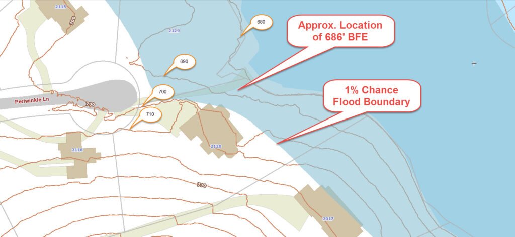 FEMA’s